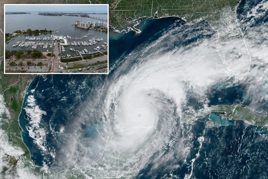
Tampa, Florida, has emerged as the focal point of concern for meteorologists and disaster preparedness experts alike, particularly as Hurricane Milton approaches the Gulf Coast. The city has been labeled the most vulnerable in the United States for hurricane storm surges, and for good reason. A convergence of geographical, demographic, and climatic factors creates a perfect storm—literally and figuratively—that could lead to catastrophic consequences for its residents and infrastructure.
According to a 2015 study conducted by disaster consultants, roughly 50% of the over 3 million people living around Tampa Bay reside at elevations less than 10 feet above sea level. This alarming statistic means that if Hurricane Milton’s projected 15-foot storm surge materializes, millions of homes could find themselves inundated. The last significant hurricane to impact Tampa Bay was in 1921, a time when the area was predominantly sparsely populated. The devastation was profound, with ocean waves crashing into downtown Tampa and sweeping away essential infrastructure, highlighting just how vulnerable the region has been for more than a century.
The geographical layout of Tampa Bay exacerbates the threat of storm surges. The bay’s shallow depths and its narrow opening create conditions that are ripe for disaster. As MIT meteorology professor Kerry Emanuel explains, the physics behind storm surges are akin to those of a tsunami, but instead of being triggered by seismic activity, they are driven by wind. “Imagine a wave approaching a beach where the water becomes shallower,” he illustrates. “The front of the wave slows down more rapidly than the back, creating a fluid traffic jam.” This phenomenon results in water piling up, leading to dangerously high surges.
The unique shape of Tampa Bay further amplifies this effect. The narrow channel serving as the bay’s opening funnels storm energy into smaller areas, causing water levels to rise dramatically. “The water is piling up left and right, not just from the bottom,” Emanuel notes, emphasizing the precarious situation. If Hurricane Milton makes landfall just north of Tampa, its counterclockwise winds will drive waves directly into the bay, compounding the already precarious storm surge scenario.
As the region has evolved into one of Florida’s most dynamic metropolitan areas, the lack of recent hurricane experience poses a psychological challenge for residents. There is a growing fear among experts that many may underestimate the storm’s potential impact, leading to a reluctance to heed evacuation orders. “Unfortunately, there will probably be a higher proportion of people who refuse to leave when asked to evacuate,” Emanuel warns, highlighting a critical concern as the storm approaches.
As of Tuesday afternoon, Hurricane Milton has intensified into a Category 5 storm, boasting sustained winds of 165 mph, raising the stakes even higher. While some trajectory models suggest the storm could potentially make landfall south of Tampa—thereby mitigating the worst impacts due to the region’s unique topography—others indicate a more dire scenario with landfall anticipated directly in the bay.
Forecasters have been careful to remind the public that it is still too early to accurately predict the storm’s exact path. The window for definitive predictions may not open until Wednesday morning or early afternoon, but the urgency for preparedness cannot be overstated.
In light of these factors, it is crucial for residents of Tampa Bay to remain vigilant and informed. Understanding the risks and the science behind storm surges can empower communities to act decisively in the face of natural threats. The stakes are high, and the time for preparation is now.


