**Flooding Rains and High Winds Hit Southern New England**
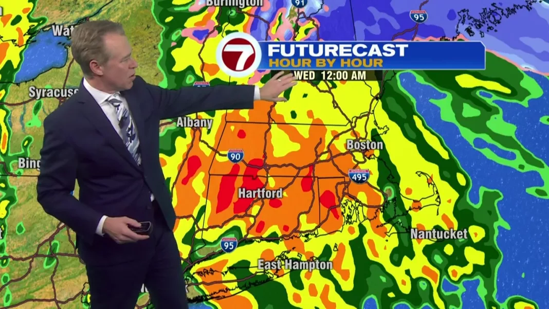
As a storm system swept into southern New England on Tuesday, residents braced themselves for up to 2 inches of rain, damaging winds, and street flooding exacerbated by melting snow. By 8 p.m., heavy rain, high winds, and even some snowflakes were reported across the state as the storm moved in from the southeast. Flood watches, high wind warnings, and other advisories were issued in response.
A flood watch was issued for most of the state, excluding the Cape and Islands, with concerns of 1.5 to 3 inches of rain and melting snow causing street and river flooding throughout the Commonwealth. In Methuen, where over a foot of snow fell on Sunday, DPW crews and residents worked diligently to clear storm drains and minimize the flood risk.
“We’ll get it done, this will all be a distant memory in a few days hopefully,” said Justin Baldwin of the Methuen Department of Public Works.
The heaviest rain was expected to hit southern New England and the Boston area between midnight and 4 a.m., with the storm likely to clear Massachusetts by 6:45 a.m. Worcester and Plymouth could experience rainfall of 2-2.7 inches, while Boston is expected to receive just under 2 inches by Wednesday morning.
In addition to a coastal flooding advisory that could bring 1-2 feet of inundation, wind gusts up to 65 mph were forecasted for the North Shore, South Shore, and Cape and Islands throughout Tuesday night. This led to a high wind warning, with some communities at risk of power outages. The rest of the state was under a wind advisory with gusts up to 50 mph overnight.
For the latest forecasts and projected storm impacts, read the 7WEATHER blog.

