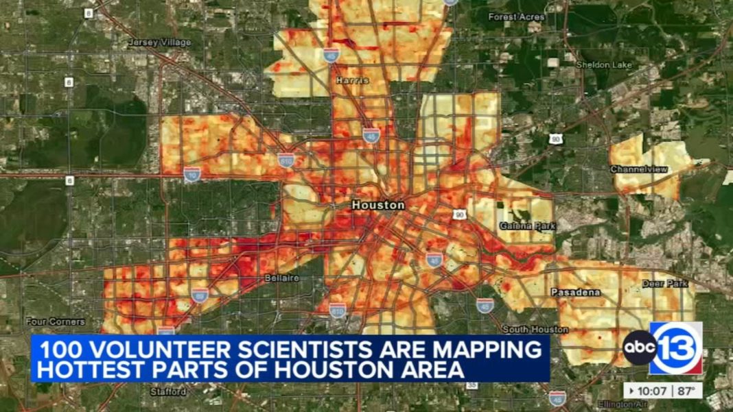
Houston Harris Heat Action Team Identifies Areas in Need of Cooling
The Houston Harris Heat Action Team recently conducted its second heat mapping project in Houston, Texas, to determine which areas are in most need of cooling. Concerned about the rising temperatures in certain parts of the city, the group deployed 100 volunteers on Saturday to collect data and analyze the findings. This initiative builds upon their previous project in 2020, which revealed Alief as Houston’s hottest community.
The team’s focus is to identify areas that experience high temperatures due to the concentration of concrete, black asphalt, and buildings. These surfaces absorb and retain heat, creating urban heat islands. To combat this issue, the group planted trees along a median on Bissonnet earlier this year, with the hope of providing more shade to the area. By strategically planting trees, they aim to reduce the overall heat in these neighborhoods.
During the recent mapping project, volunteers were equipped with heat sensors, which they mounted in their car windows. They drove along predetermined routes for an hour at a time, collectively covering a distance of 1,261 miles. This data collection method allowed the team to gather accurate and comprehensive information about the temperature variations across different parts of the city.
One volunteer, Monique Crawford, spent her afternoon driving through Spring Branch, a potential site for future tree planting. Crawford emphasized the importance of considering socioeconomic challenges in certain areas. By planting trees in these regions, it is possible to address both the heat issue and the specific needs of the community.
Now that the data has been collected, the Houston Harris Heat Action Team will take several months to process and analyze it thoroughly. They plan to publish the findings in either October or November, providing valuable insights into the hottest areas of Houston. This information will help the community develop targeted strategies to address the heat problem effectively.
The previous heat mapping project’s data from 2020 is also available for public viewing. This allows residents and policymakers to gain a better understanding of the areas most affected by extreme heat. By studying the data, stakeholders can identify patterns and trends, enabling them to make informed decisions regarding heat mitigation measures in the future.
The Houston Harris Heat Action Team’s dedication to combating the heat issue in Houston showcases the importance of community-driven initiatives. By engaging volunteers and leveraging data collection methods, they are able to gather accurate information that will contribute to the development of effective solutions. The project’s success lies not only in identifying the hottest areas but also in considering socioeconomic factors and involving the community in the decision-making process.
As Houston continues to experience rising temperatures and the impact of urban heat islands, the efforts of the Houston Harris Heat Action Team serve as a model for other cities facing similar challenges. The importance of data-driven strategies and community involvement cannot be overstated in addressing the adverse effects of extreme heat. By implementing tree planting initiatives and other heat mitigation measures, cities can create more livable and sustainable environments for their residents.


